Historic Real-Estate Maps of Toowong
The maps of Toowong and surrounding areas below are from 1861 to 1936. Some maps show Government Road - this is a placeholder name for the road.
In the 1930s the Council decided to rename many streets in Brisbane to make their names unique. The names listed below are the names shown on the maps and may not be the street names in use today. For example:
- Church Street was renamed Jephson Street, after Letitia Jephson.
- Heussler Terrace, named after Johann Christian Heussler, was renamed Birdwood Terrace.
- Third Avenue off Birdwood Terrace was renamed Couldrey Street.
- River Road was renamed Coronation Drive in honor of the coronation of King George VI.
- St. Lucia Road was renamed Sir Fred Schonell Drive after the vice-chancellor of the University of Queensland from 1960 to 1969.
For more information, see:
- A Guide - History of Street Naming in Brisbane - A guide detailing the process for street naming by Council and a guide to using the street naming records held by the City Archives. Brisbane City Council Archives.
- Duplicate Street Names - Extracts from Committee Reports with reasons 1938 - 1939 - Extracts from Minutes of Works Committee meetings where street renames were approved. Includes derivation of name. Brisbane City Council Archives.
- Duplicated Street names - List Assigned New Street Names May 1939 arranged by NEW street Name - Final Schedule published by Council of duplicated streets approved to rename to May 1939. Entries arranged alphabetically by new name with reference to former name. Brisbane City Council Archives.
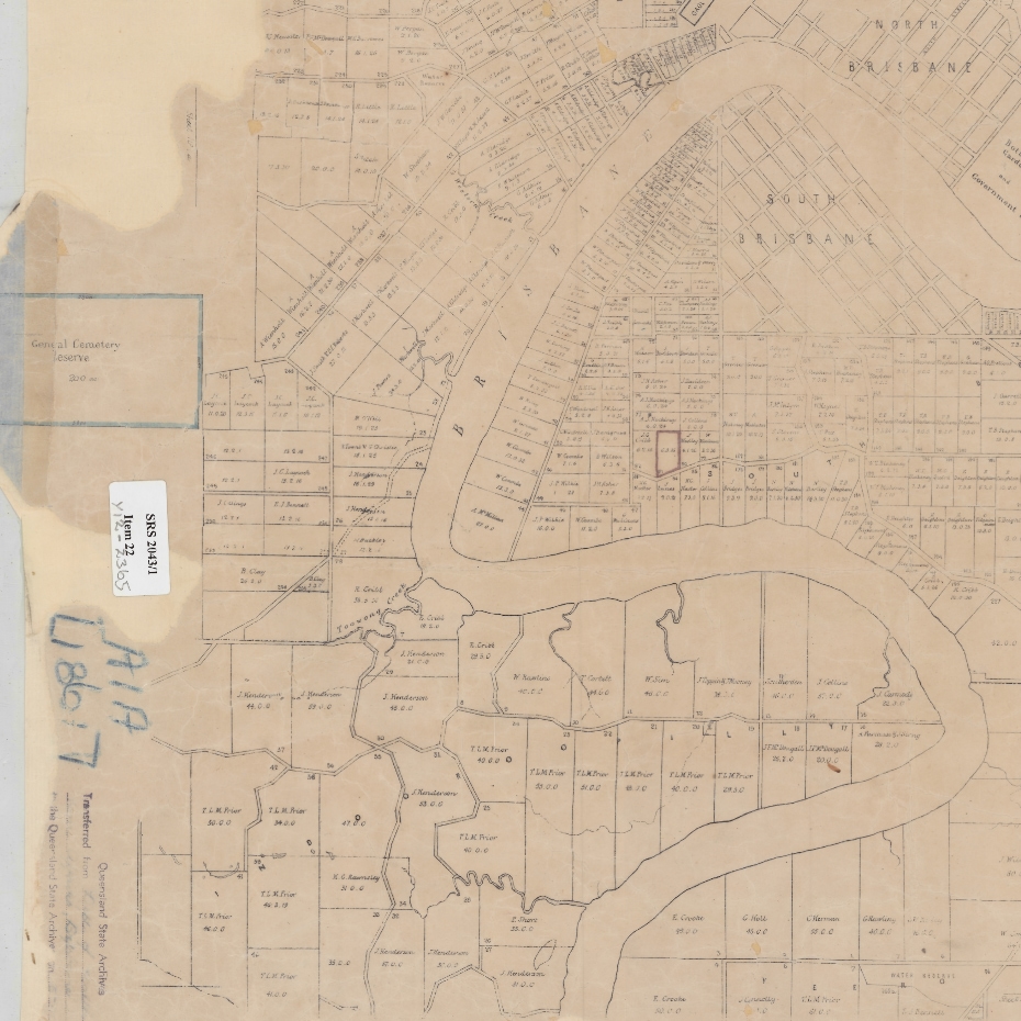
Toowong Cemetery Reservation c1861
Map showing the Toowong Cemetery Reservation.
City of Brisbane, County of Stanley, showing Toowong Cemetery Reservation; being sheet 1b of a 20 chain grid series. 20 chains to the inch. Survey Office, Brisbane., ca. 1861 — Queensland State Archives. Cropped.
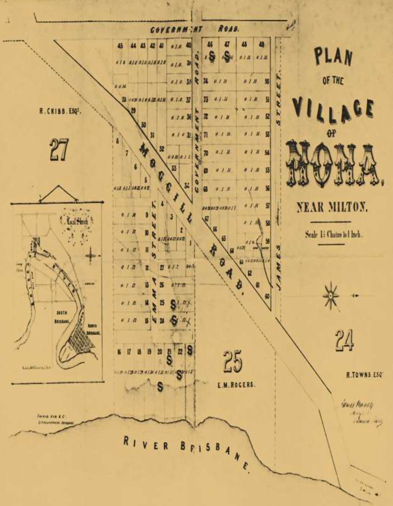
Village of Nona c1865
The Village of Nona map shows: Moggill Road, Emma Street, and James Street.
Source unknown
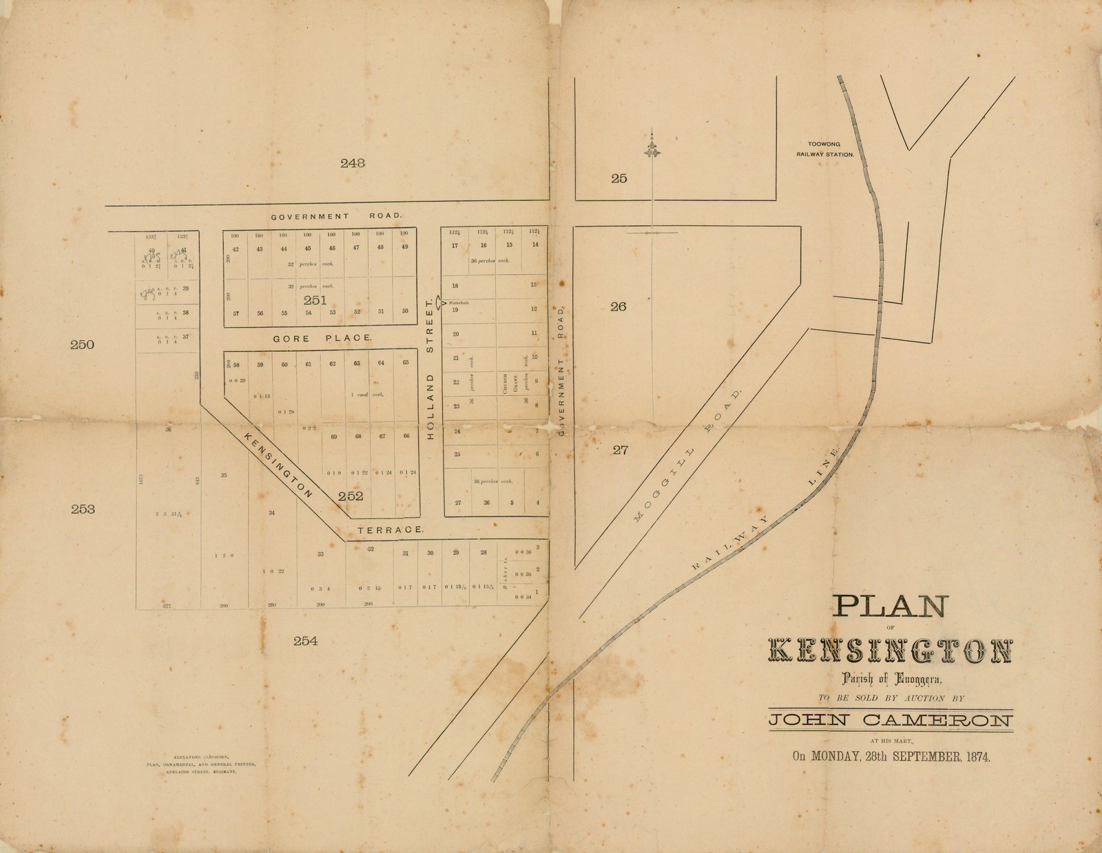
Kensington 1874
Kensington, near Toowong Railway Station shows: Kensington Terrace, Moggill Road, Gore Place, and Holland Street.
Plan of Kensington, Parish of Enoggera, to be sold by auction by John Cameron at his mart, on Monday, 28th September, 1874. State Library of Queensland
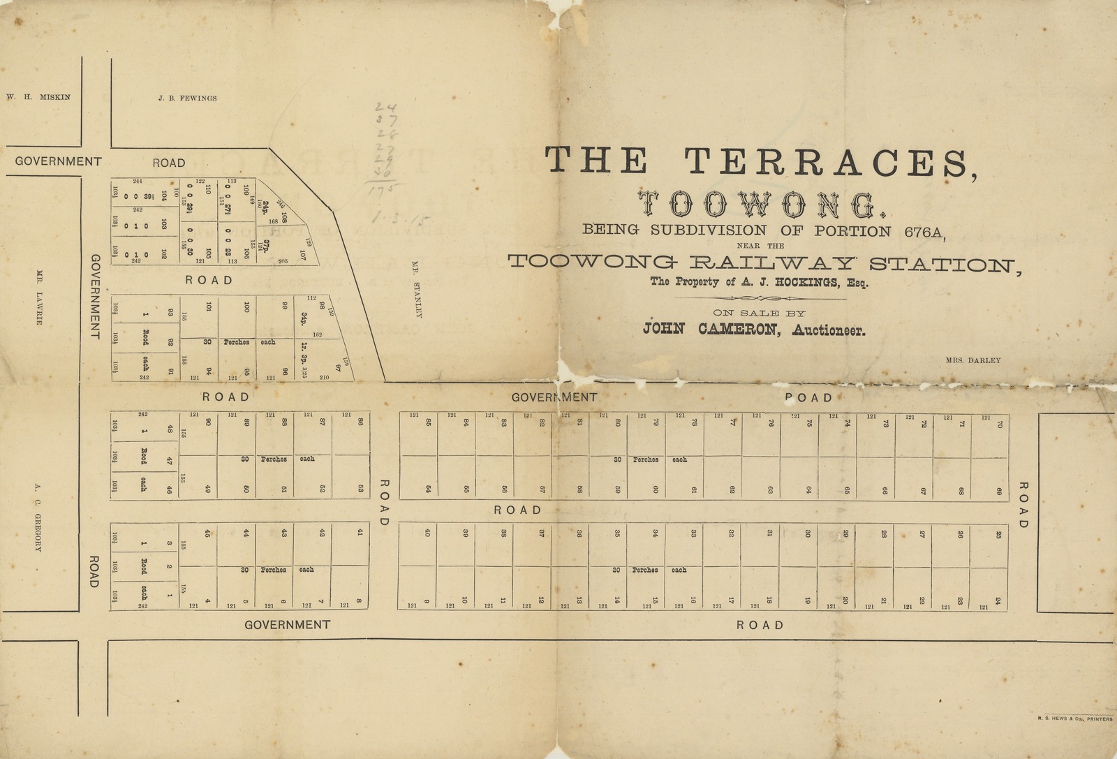
The Terraces Estate 1874
Advertised on page 4 in The Telegraph, 12 September 1874.
The Terraces [Estate], Toowong near the Toowong railway station / John Cameron, Auctioneer. 1870-1900, State Library of Queensland
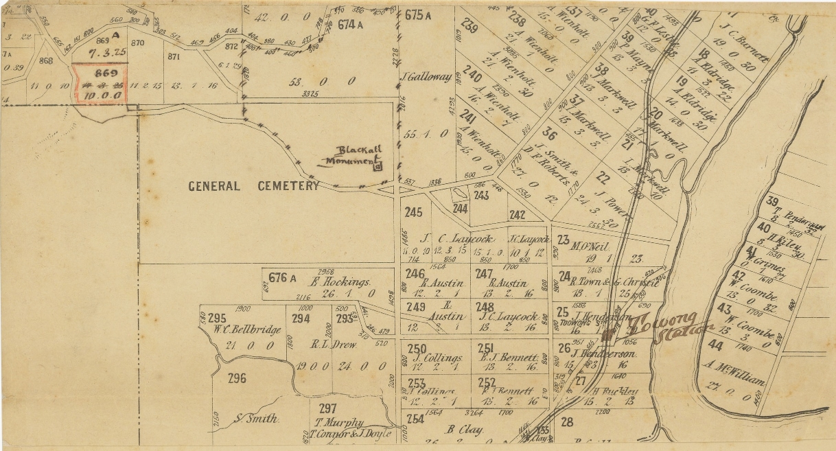
Parish of Enoggera, 1876
Showing land owners and Brisbane General Cemetery and Toowong Station.
Plan of portions no.s 830b, 865, 866, 866a, 867, 867a & 868 to 872, Parish of Enoggera, County of Stanley, District of Moreton State Library of Queensland. Cropped.
Sylvan Grove Estate, 1880
Sylvan Grove Estate, next to Lang Farm, included Wilson street and Elizabeth street.
Mr. John W. Todd reported the sale of allotment 6 in the *The Brisbane Courier on 3 July 1880.
Plan of the Sylvan Grove Estate, Toowong, being subdivisions 1 to 28 part of portion 256, Enoggera John W. Todd [auctioneer], State Library of Queensland
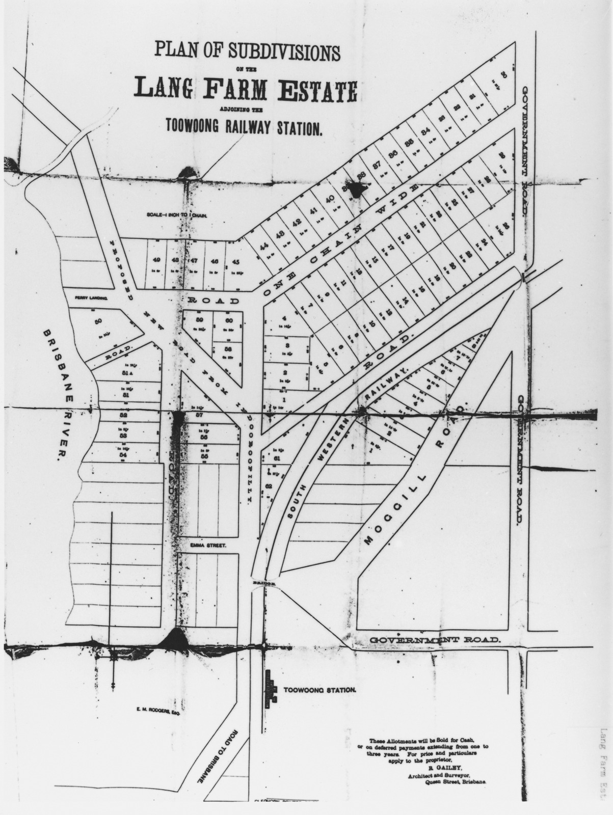
Lang Farm Estate ca.1881
The Lang Farm Estate map shows: the Toowong Railway Station, Moggill Road, Emma Street, and a Ferry Landing on the Brisbane River.
An advertisement for sub-divisions of the Lang Farm Estate appeared in The Brisbane Courier on 2 November 1881.
Plan of subdivisions on the Lang Farm Estate adjoining the Toowong Railway Station. 188-, State Library of Queensland
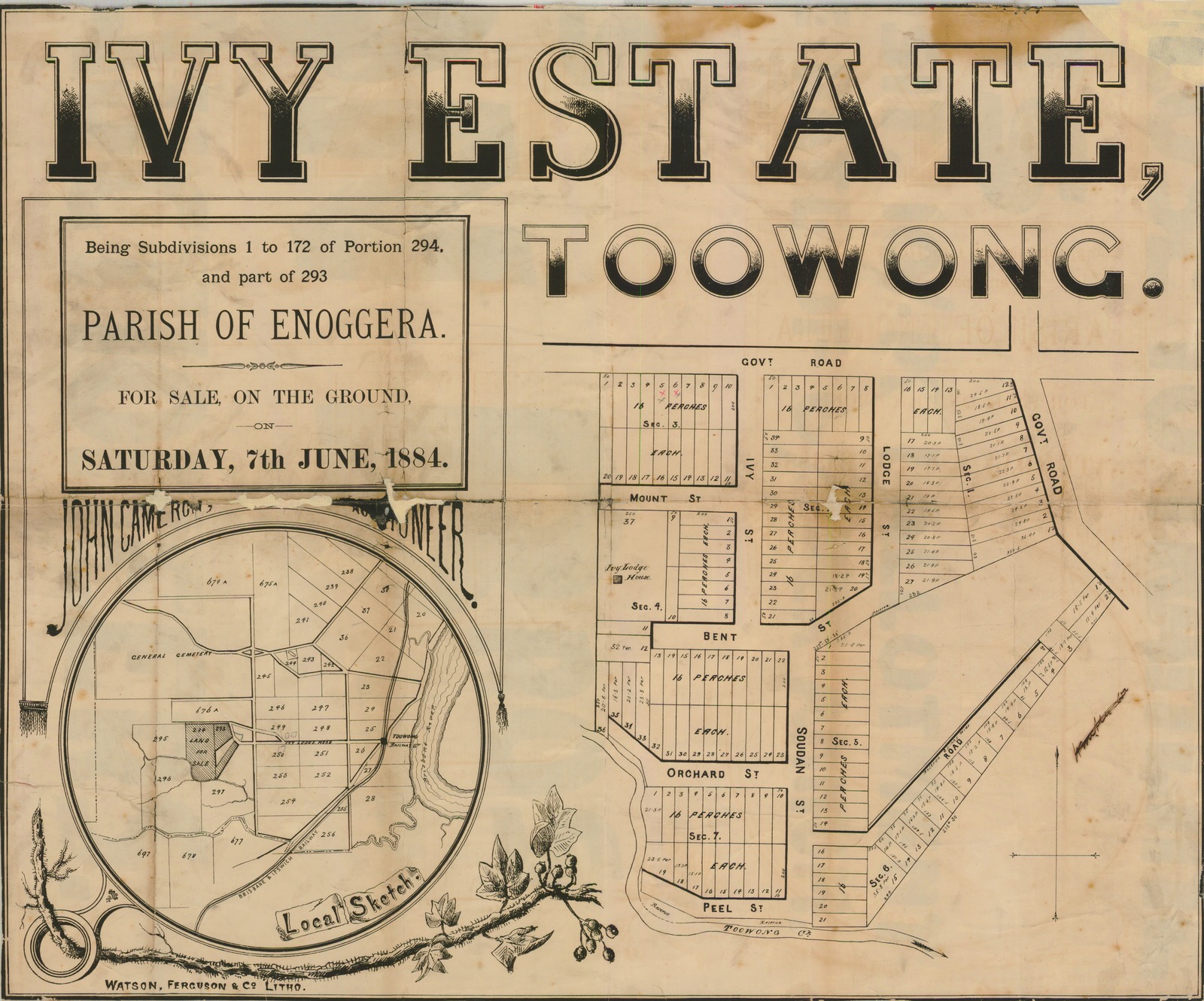
Ivy Estate 1884
The Ivy Estate map shows: Ivy Street, Ivy Lodge House, Lodge Street, Mount Street, Bent Street, Orchard Street, Peel Street and Soudan Street.
Ivy Estate, Toowong being subdivisions 1 to 172 of portion 294, and part of 293 : Parish of Enoggera. 1884, State Library of Queensland
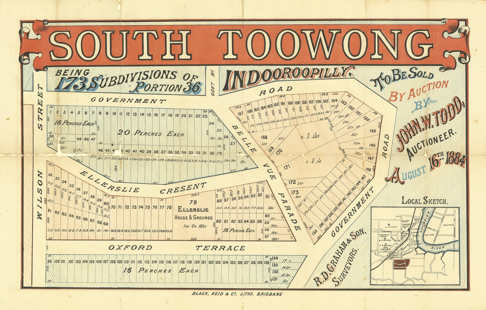
South Toowong 1884
Map shows area near Ellerslie Crescent Oxford Terrace, Wilson Street and Belle Vue Parade, near Perrin Park in what is now Taringa.
South Toowong : being 173 subdivisions of portion 36, Indooroopilly 1884, State Library of Queensland
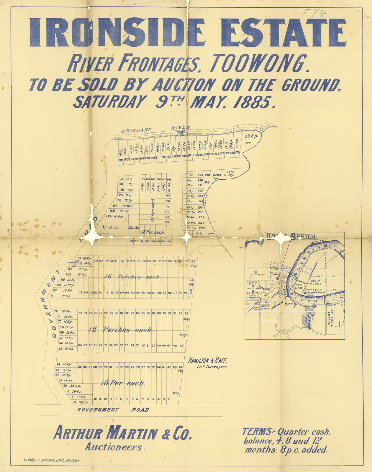
Ironside Estate 1885
The Ironside Estate map shows: Sherwood Road, Sherwood Grove, Union Athletic Club, High Street, Kensington Terrace, Ashton Street, and Justling Street.
Ironside Estate, Toowong, 1885. State Library of Queensland
Middenbury Estate 1885
Map shows allotments for sale in an area between the railway station on High Street and the Brisbane River in Toowong.
Middenbury Estate, Toowong, 1885. State Library of Queensland
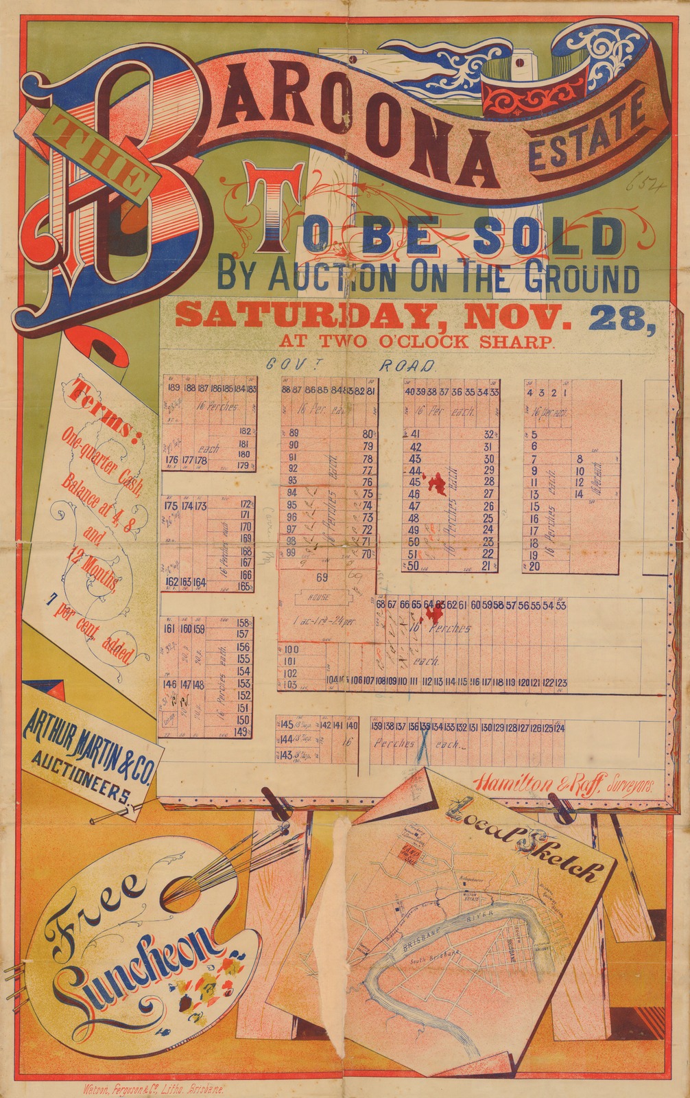
Baroona Estate 1885
Map shows allotments for sale near today's Rosalie Village and Government House.
The Baroona Estate To be sold by auction on the ground Saturday, Nov. 28, at two o'clock sharp., 1885. State Library of Queensland
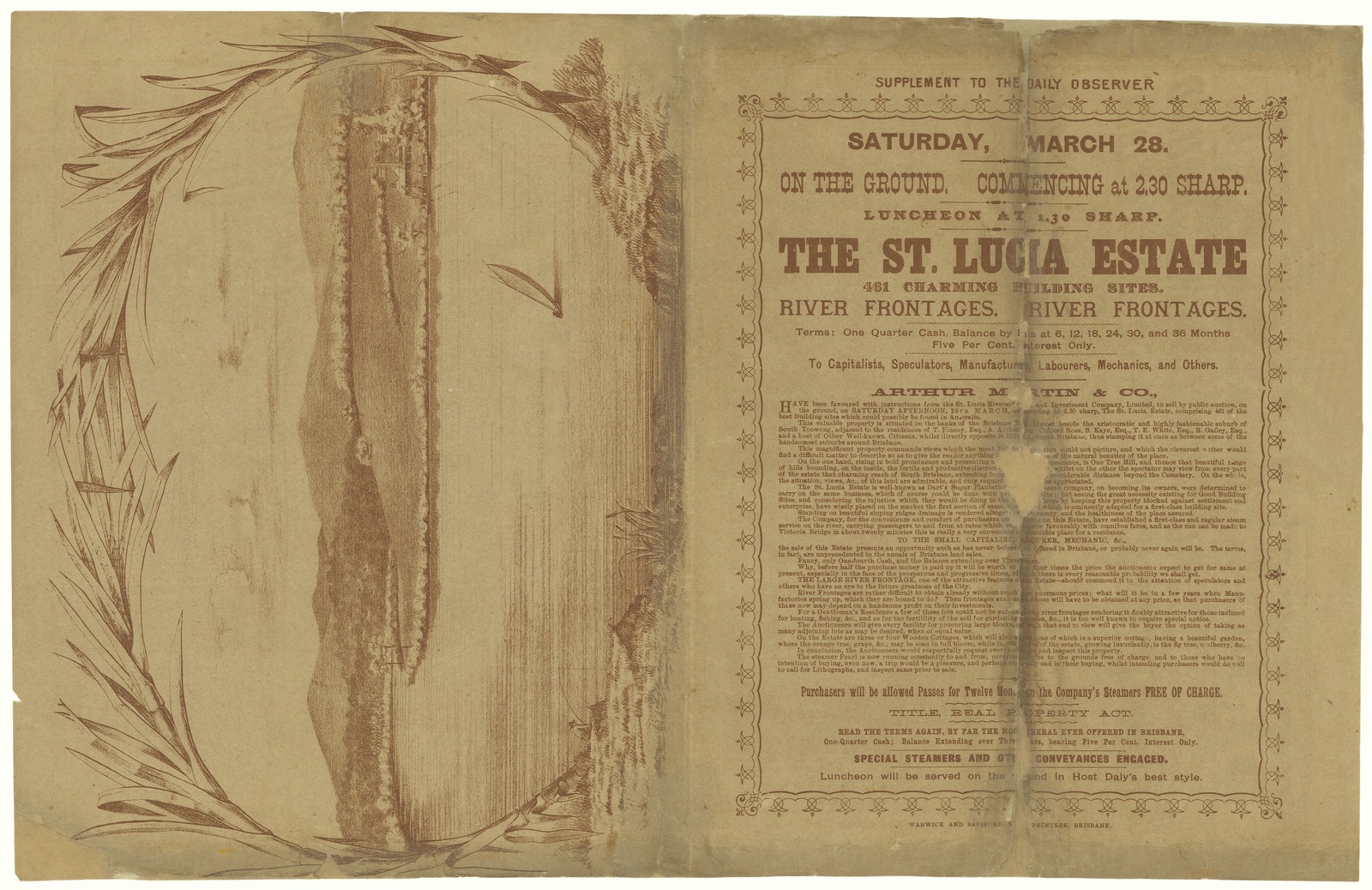
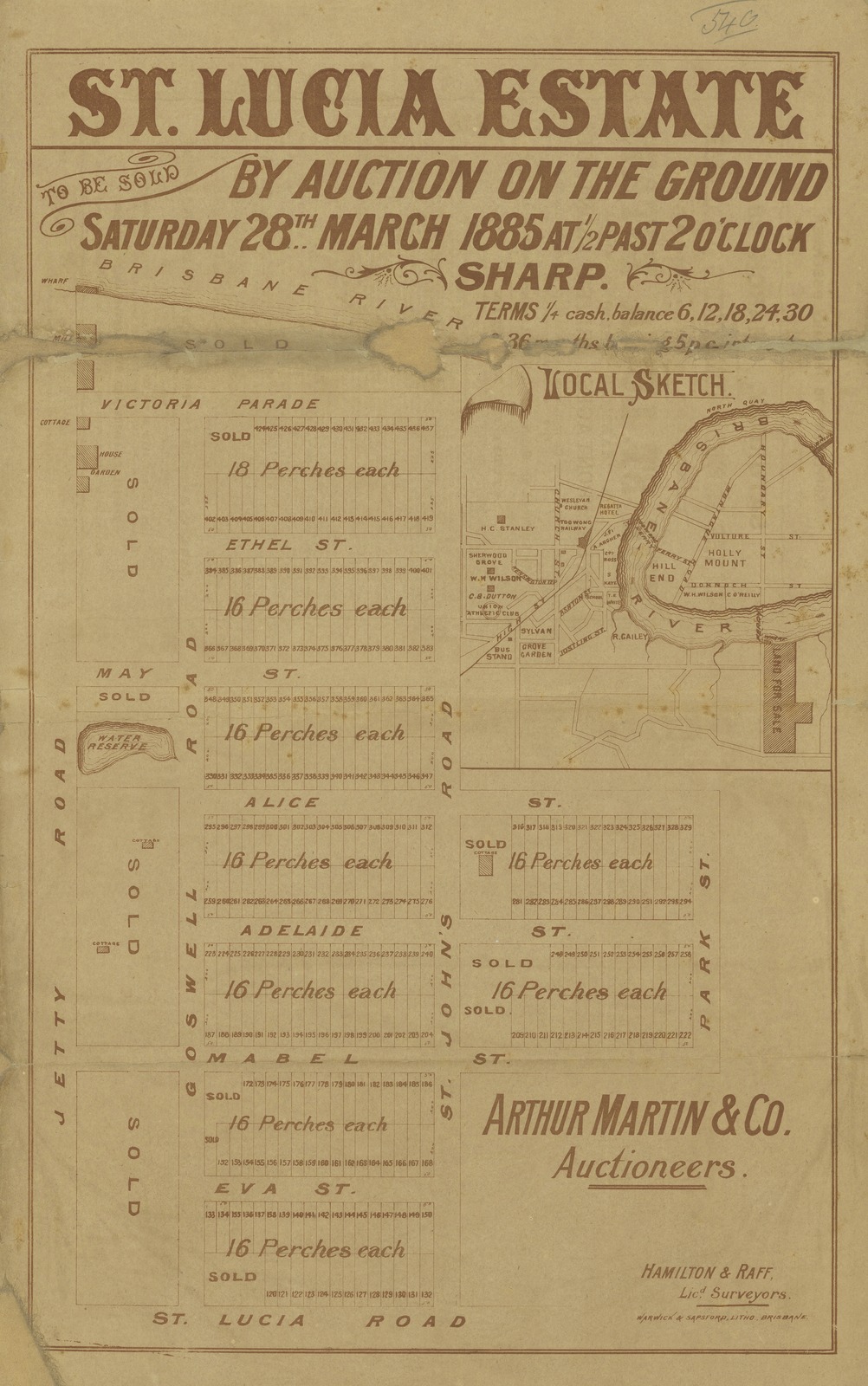
St. Lucia Estate 1885
Map shows an area in St Lucia with a river frontage opposite Boundary Road, West End, now part of the campus of the University of Queensland.
St. Lucia Estate, 1885. State Library of Queensland
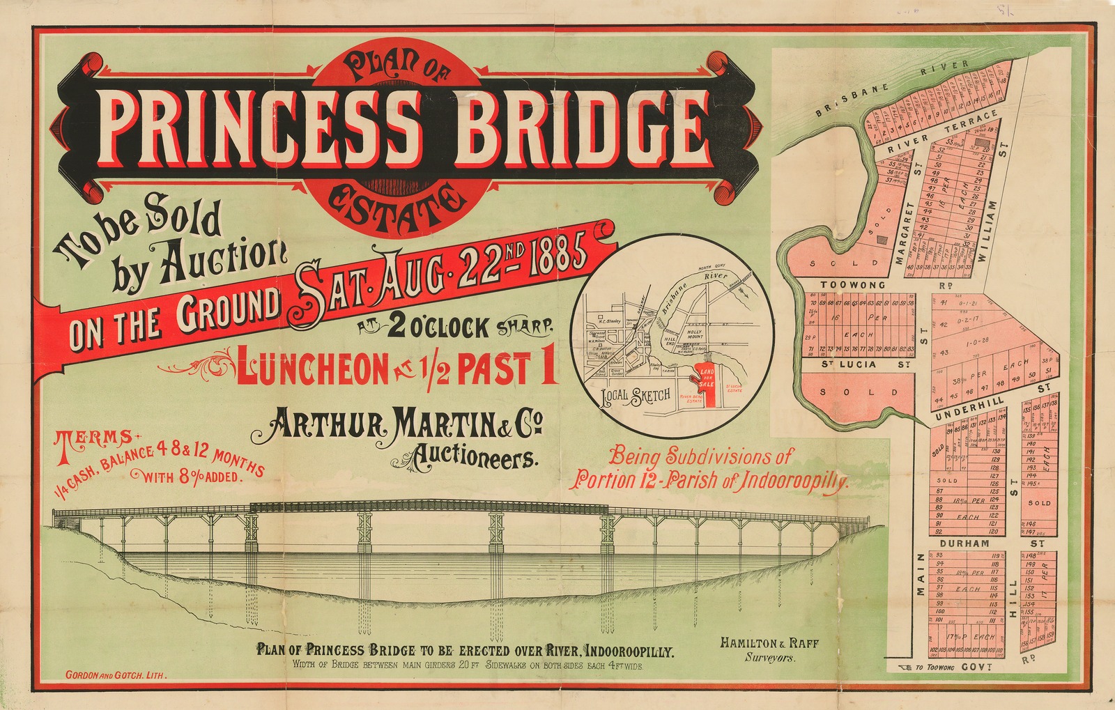
Princess Bridge Estate 1885
Map showing allotments for sale at St.Lucia near where the University of Queensland is now located. None of the roads shown seem to exist today. The map also shows a plan of the proposed Princess Bridge that was to be erected across the Brisbane River to meet Boundary St, West End. Floods in 1887 and 1890 probably deterred construction.
Plan of Princess Bridge Estate To be sold by auction on the ground Sat. Aug. 22nd 1885. State Library of Queensland
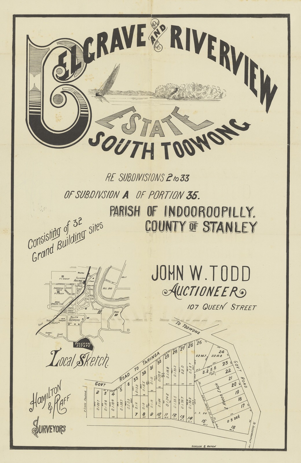
Belgrave and Riverview Estate
The Belgrave and Riverview Estate is near the intersection of Swann Road and Indooroopilly Road.
Belgrave and Riverview Estate, South Toowong John W. Todd, Auctioneer ; Hamilton & Raff, surveyors. no date, State Library of Queensland
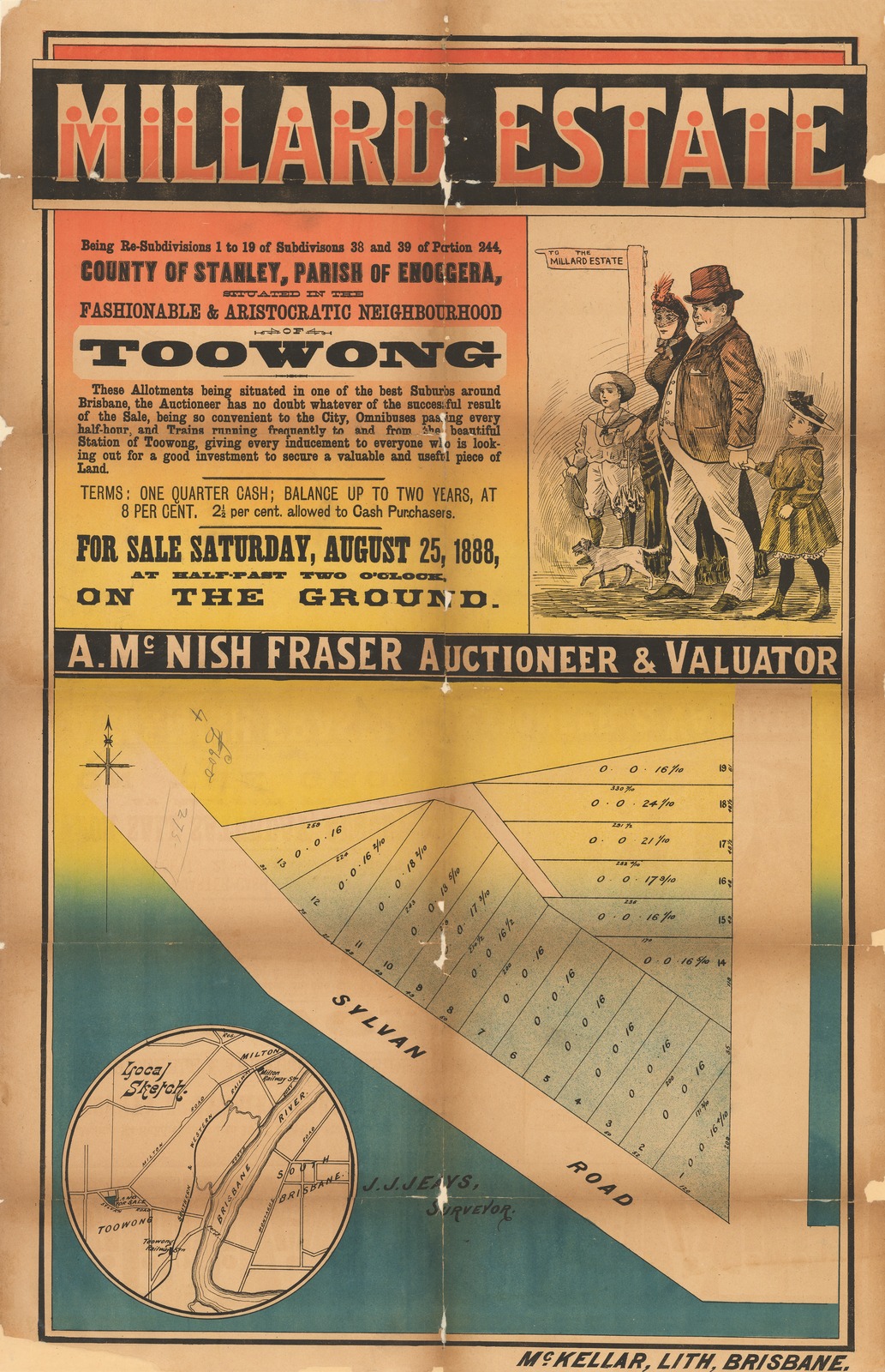
Millard Estate 1888
The Millard Estate map shows: Sylvan Road, Moggill Road, the Toowong and Milton Railway Stations, and the Ferry crossing between Toowong and South Brisbane.
Millard Estate, Toowong A.M. McNish Fraser, Auctioneer ; J.J. Jeays, Surveyor. 1888, State Library of Queensland
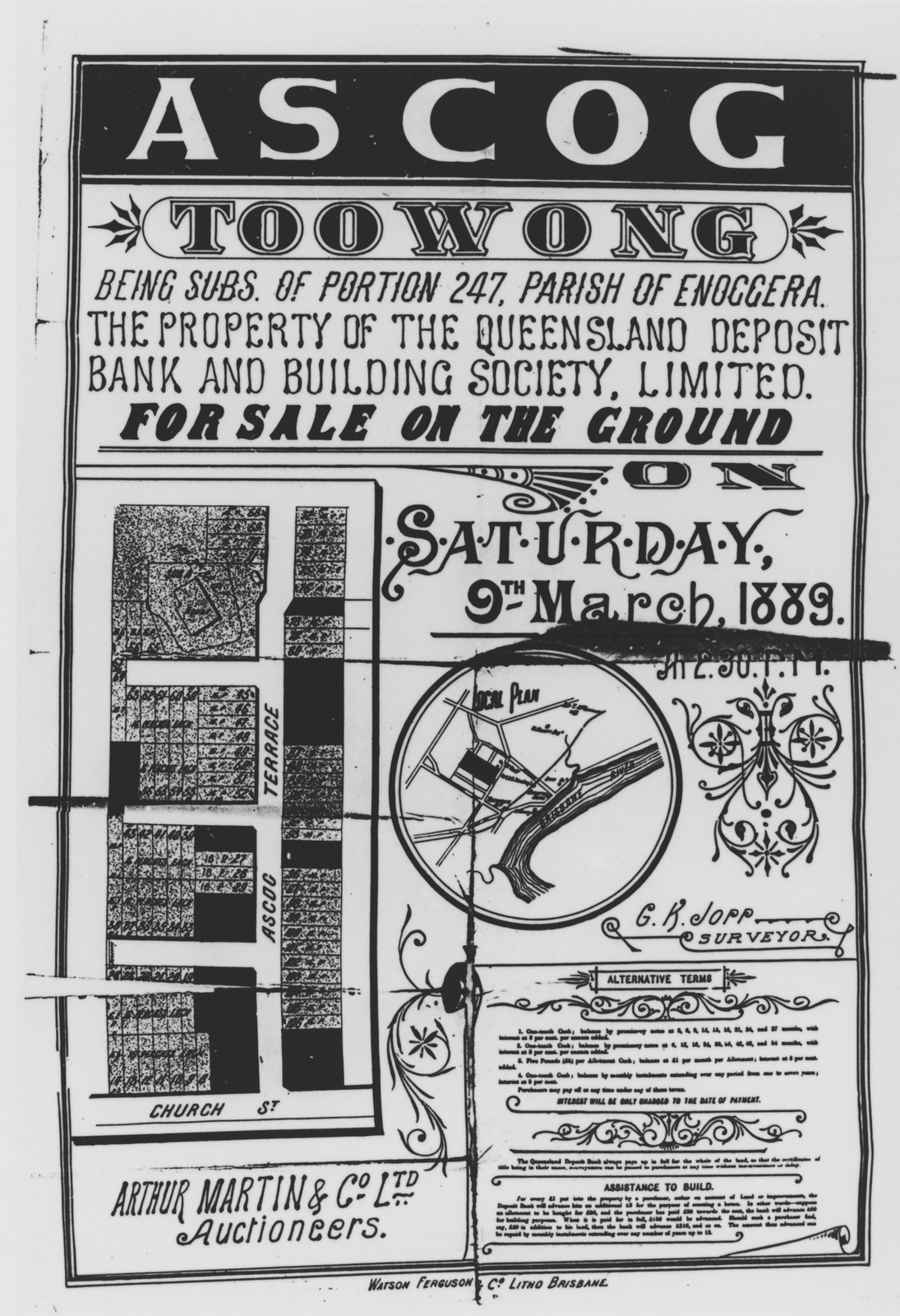
Ascog Estate 1889
The Ascog Estate map shows: Ascog Terrace and Church Street.
Advertising poster for the sale of land at Ascog Estate, Toowong. 1889 Brisbane John Oxley Library, State Library of Queensland
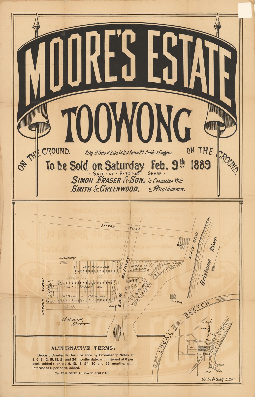
Moore's Estate 1889
The Moore's Estate map shows: Sylvan Road, Church Street, the Toowong Railway Station, the Regatta Hotel, and marked in pencil Augustus Street and Jane Street.
Moore's Estate, Toowong being re-subs 1 & 2 of portion 24 Parish of Enoggera. 1889, State Library of Queensland
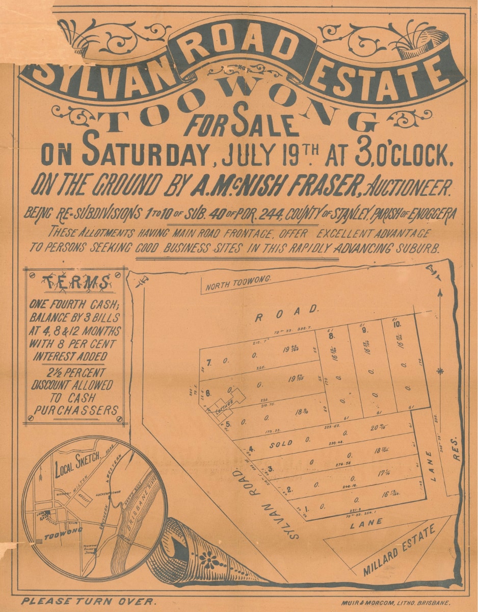
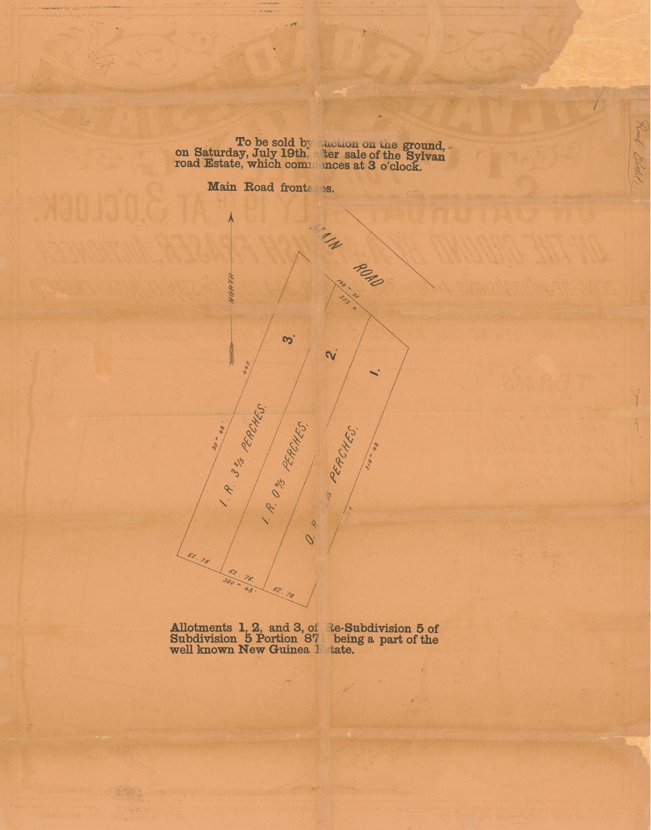
Sylvan Road Estate 1890
The Sylvan Road Estate map shows: Sylvan Road, Milton Road, Weinholt Street, and the Toowong and Auchenflower Railway Stations.
Sylvan Road Estate, Toowong. 1890, State Library of Queensland
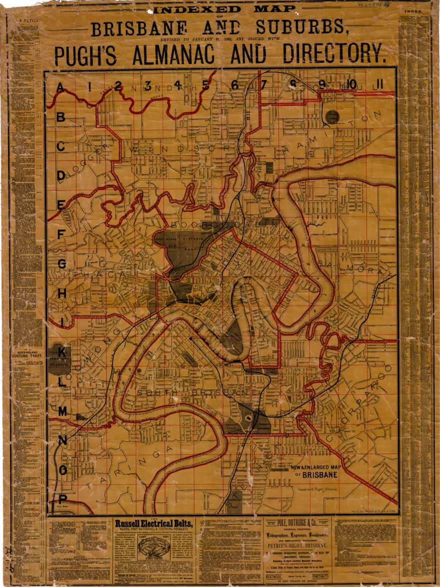
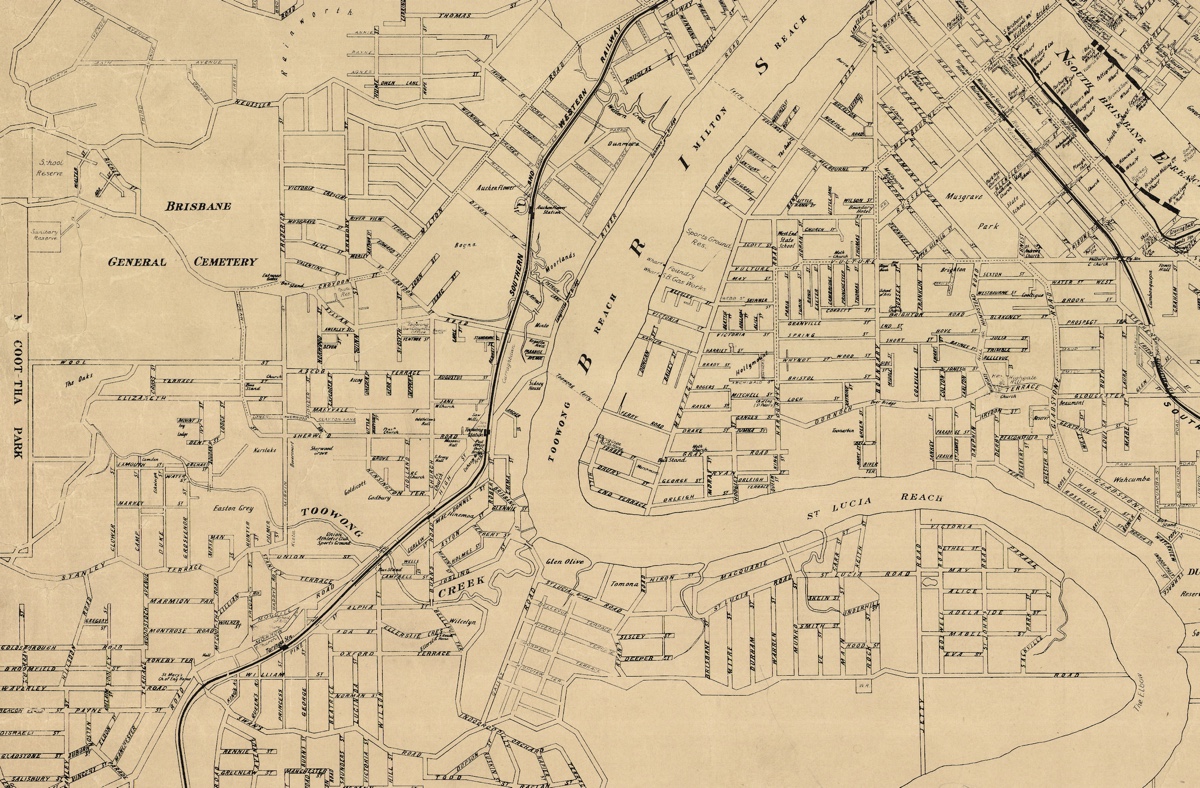
Pugh's Map of Brisbane 1892
Map Brisbane and Suburbs Indexed with Street Name List - Pugh's 1892. 1892, Brisbane City Council Archives
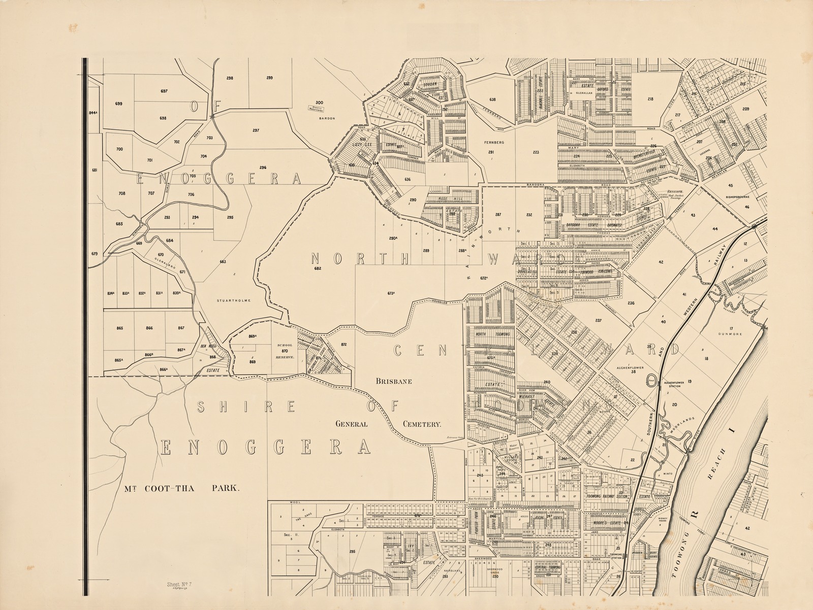
McKellar's official map of Brisbane & suburbs 1895
This map from the Surveyor-General’s Office shows many Estate and House names including: Ascog, Blackall, Brewsterfield, Baroona, Bayswater, Ben Nevis, Douglas, Grosvenor, Ivy, Karslake, Lizzy Lee, Millard, Mindenbury, Moore's, New Guinea, North Toowong, Oxford, Pioneer Park, Rose Hill, Sherwood Grove, Soudan, Torwood, Weinholt and Young's Estate.
And Houses including: Bishopsbourne, Boyna, Dovercourt, Glenalbro, Glenallan, Ivy Lodge, Minto, Moorlands and Sidney House.
McKellar's official map of Brisbane & suburbs (Sheet 7), 1895. State Library of Queensland.
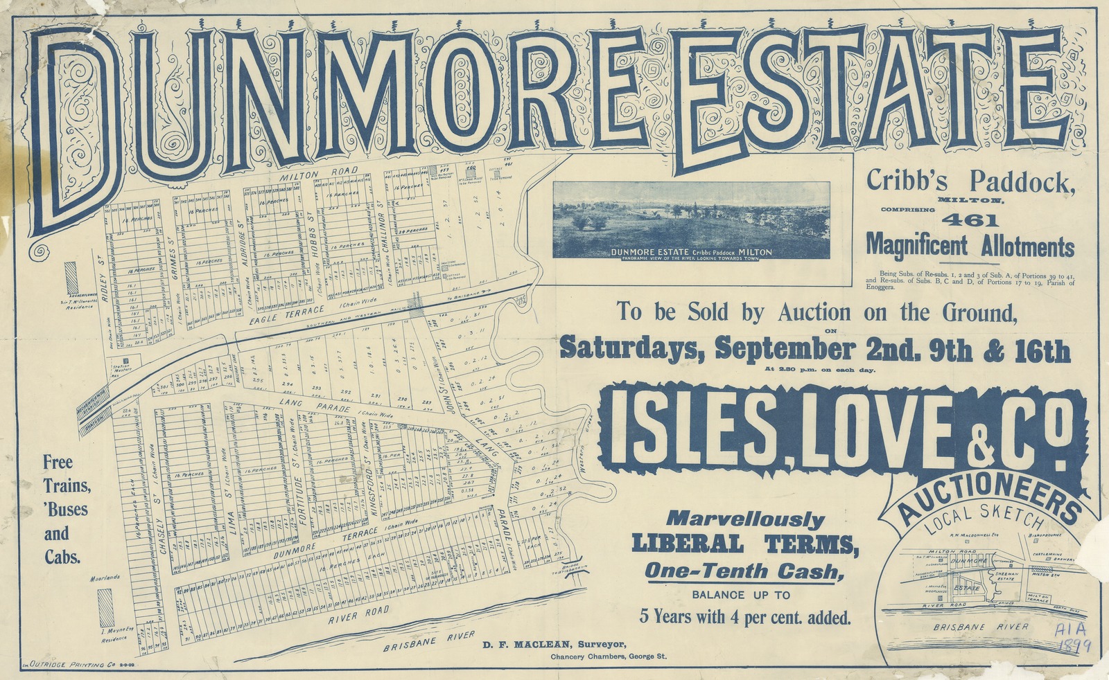
Dunmore Estate Cribb's Paddock 1899
The Dunmore Estate map shows: Auchenflower Railway Station, River Road, Dunmore Terrace, Eagle Terrace, Lang Parade, Chasley Street, Lima Street, Fortitude Street, Kingford Street, John Street, Ridley Street, Grimes Street, Aldridge Street, Hobbs Street, Challinor Street, and Milton Road.
Dunmore Estate Cribb's Paddock, Milton / Isles, Love Land Agents ; D. F. Maclean, Surveryor. 1899, State Library of Queensland
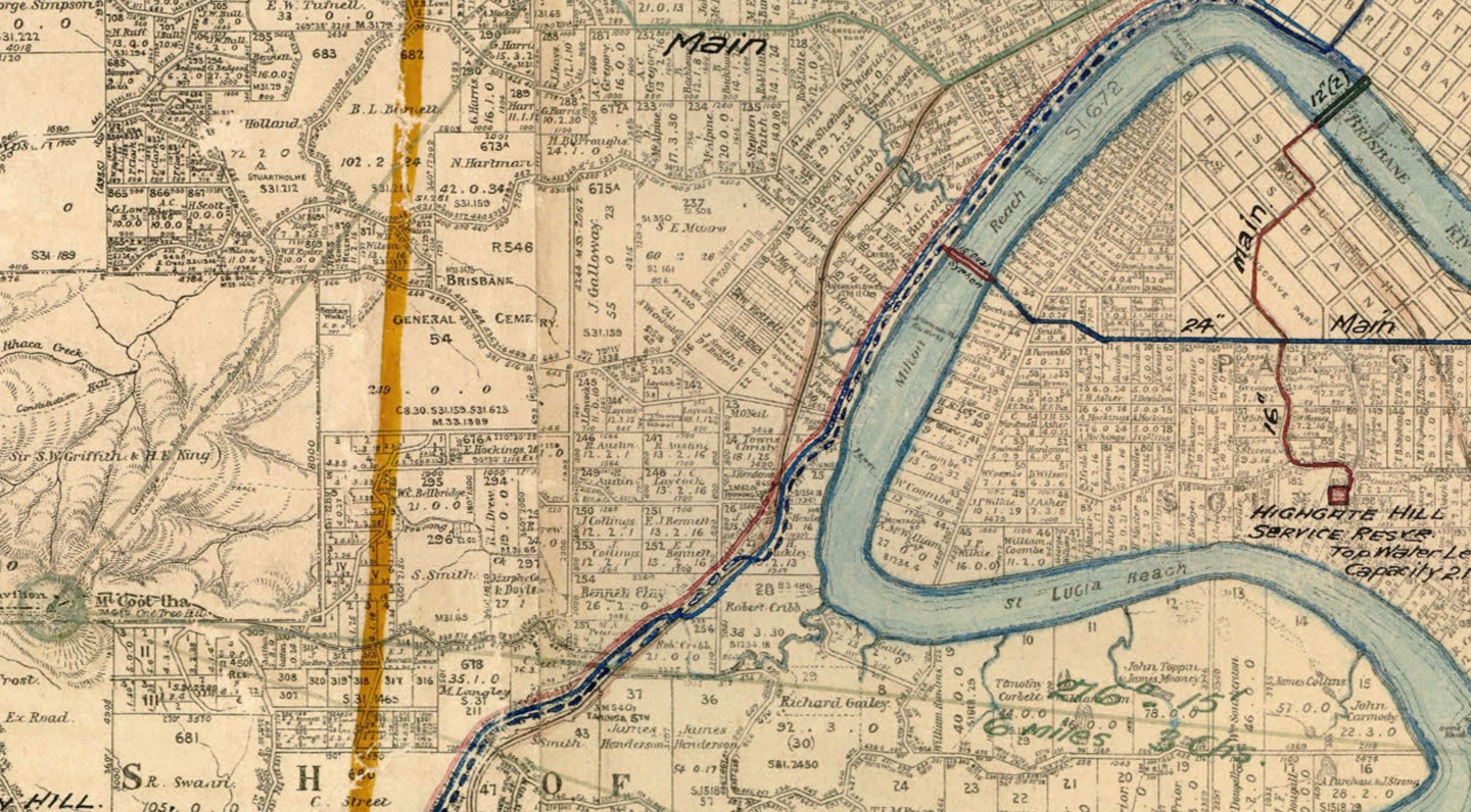
Brisbane Land Owners c1900
Brisbane Parish Map showing landowners c1900. Brisbane City Council Archives. Cropped.
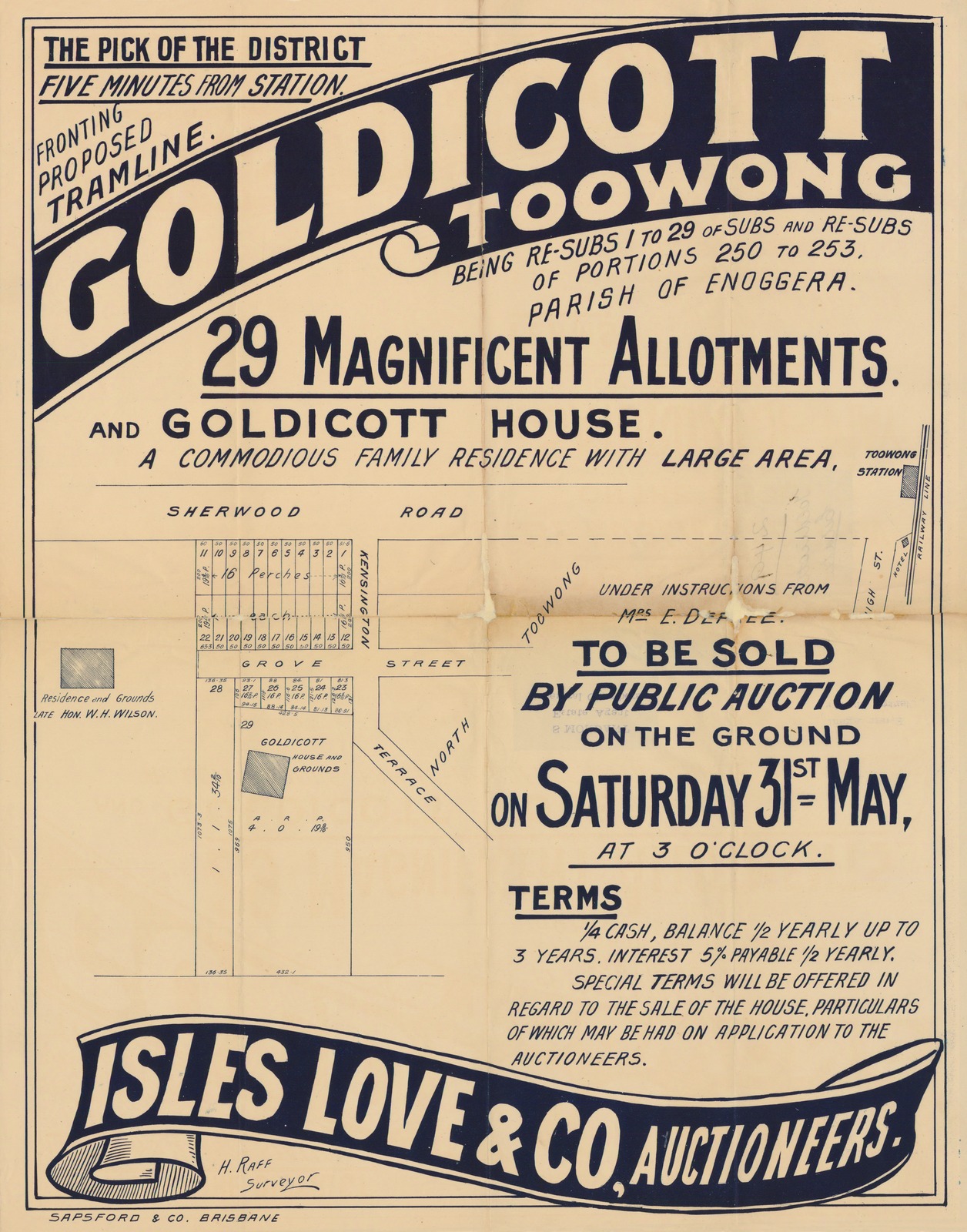
Goldicott 1902
The Goldicott Estate map shows: Sherwood Road, Kensington Terrace, and Grove Street.
Goldicott Toowong being re-subs. 1 to 29 of subs. and re-subs. of portions 250 to 253, Parish of Enoggera. 1902, State Library of Queensland
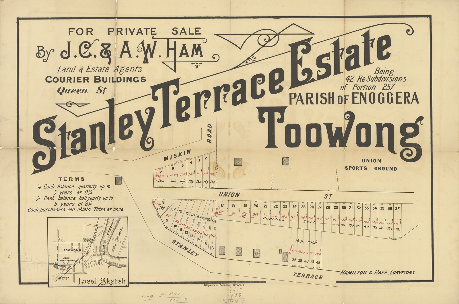
Stanley Terrace Estate 1904
The Stanley Terrace Estate map shows: Stanley Terrace, Miskin Road, and Union Street.
Stanley Terrace Estate Toowong : being 42 re subdivisions of Portion 257, Parish of Enoggera. 1904, State Library of Queensland.
Brisbane Street Map 1904
Brisbane and suburbs, street and road map, with boundaries of local authorities Queensland State Archives, Item ID ITM634549. Cropped.
Parish of Enoggera
Plan of re-subdivision 61 of subdivision 12 of portion 26 and re-subdivisions 1 to 125 of subdivisions 4 and 2 of portions 27 and 28 Parish of Enoggera R. Gailey, Architect and Surveyor. No date, State Library of Queensland
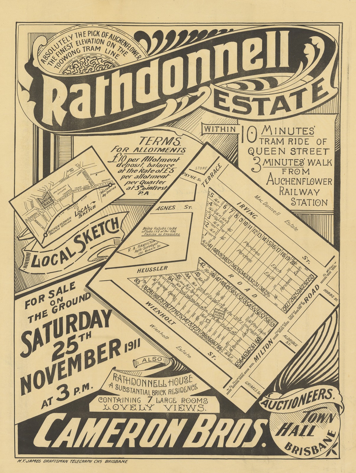
Rathdonnell Estate 1911
The Rathdonnell Estate map shows: Heussler Terrace, Weinholt Street, Irving Street, Agnes Street, Payne Street, and Milton Road.
Rathdonnell Estate, Toowong, near Auchenflower station. 1911, State Library of Queensland
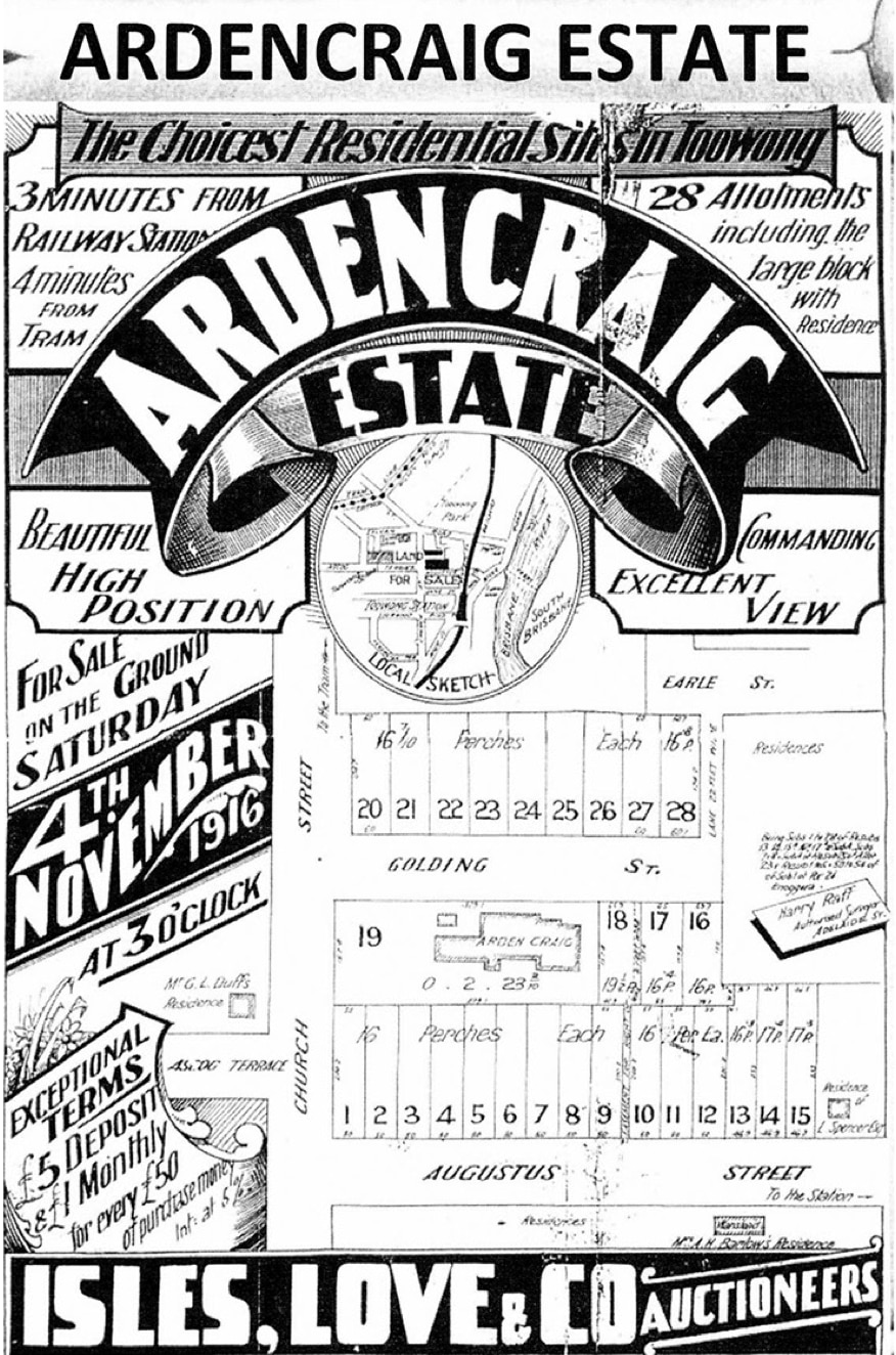
Ardencraig Estate 1916
The Ardencraig Estate map shows: Church Street, Augustus Street, Golding St, and Earle Street.
Ardencraig Estate, Toowong 1916. Provided by Marilyn England
Chermside Park 1921
Allotments on Heussler Terrace (renamed Birdwood Terrace) on the North boundary of the cemetery were sold by auction in 1921. "Convenient to the Toowong Tram Line" was a selling point. The Toowong Tram stopped near the main cemetery gates.
Third Avenue was renamed Couldrey St in 1939 after a Queensland Miner.
Chermside Park, second section : Auchenflower, 1921 — State Library of Queensland. Note in the Inset how the tram stopped at the Toowong Cemetery gates.
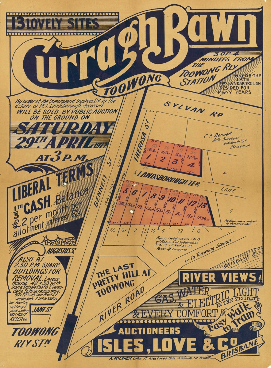
Curragh Bawn 1922
The Curragh Bawn map shows: Sylvan Road, River Road, Bennett Street, Theresa Street, Landsbourough Terrace, and the Toowong Railway Station.
Curragh Bawn, Toowong. 1922, State Library of Queensland
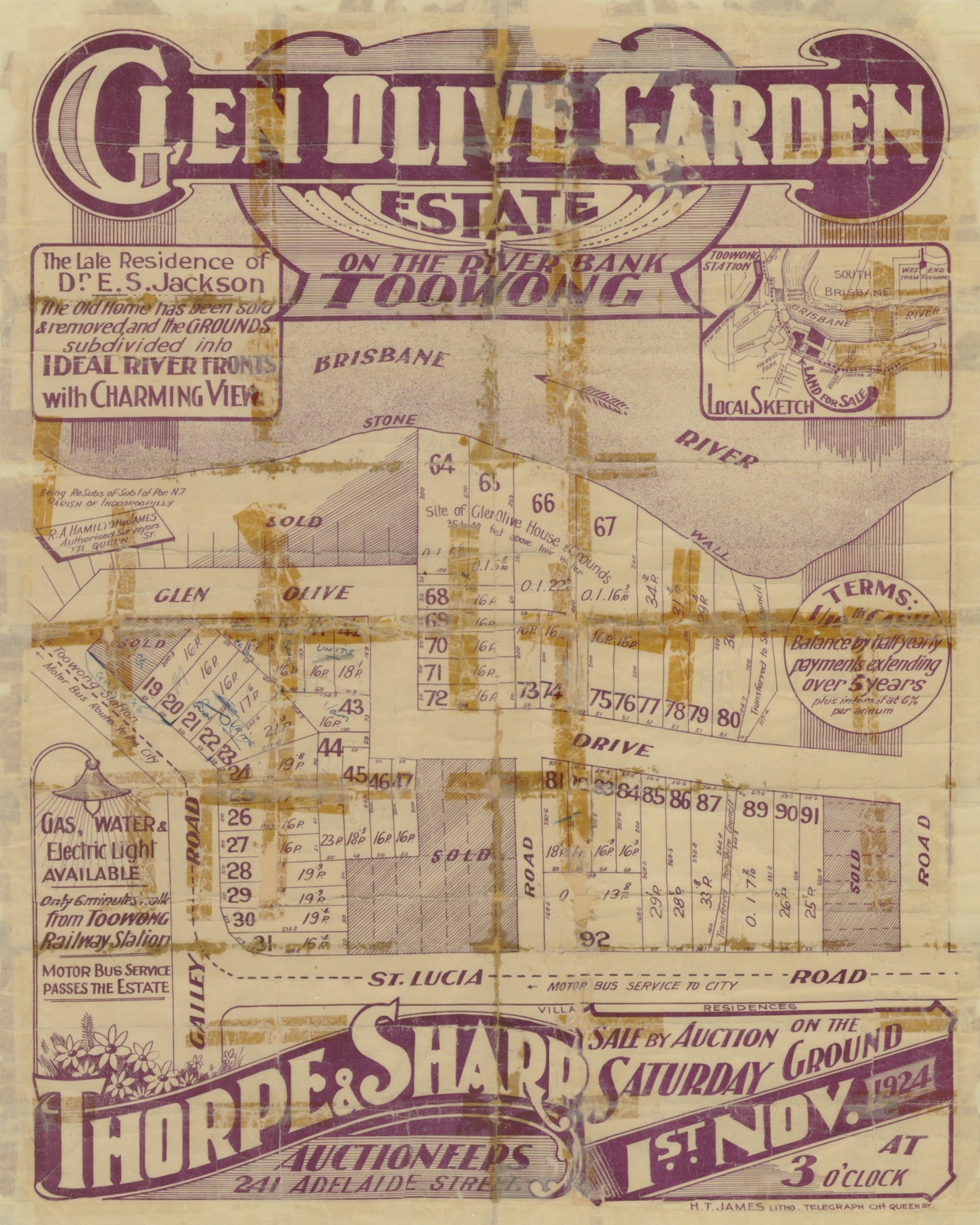
Glen Olive Garden Estate 1924
The Glen Olive Garden Estate map shows: Glen Olive Drive, St. Lucia Road, and Gailey River Road.
Glen Olive Garden Estate on the river bank Toowong. 1924, State Library of Queensland
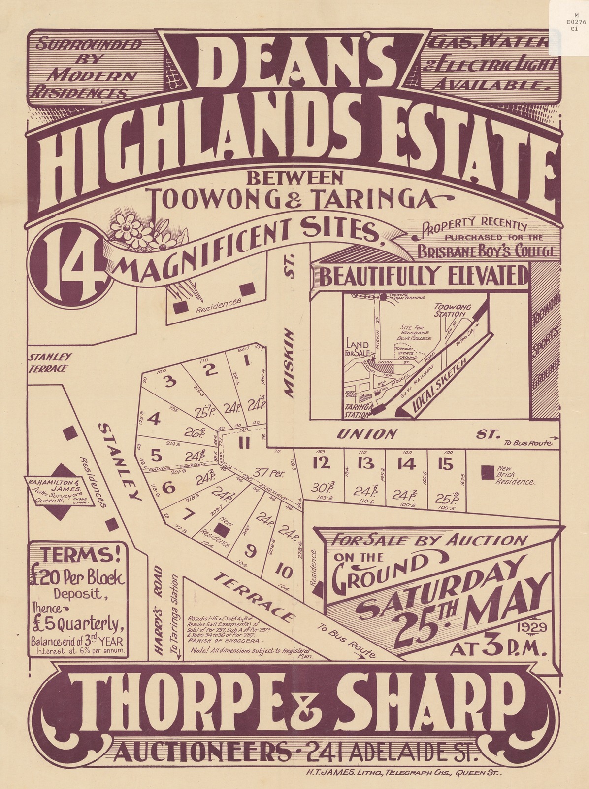
Dean's Highlands Estate 1929
Dean's Highlands Estate map shows: Miskin Street, Union Street, and Stanley Terrace.
Dean's Highlands Estate between Toowong and Taringa, 1929 1929, State Library of Queensland
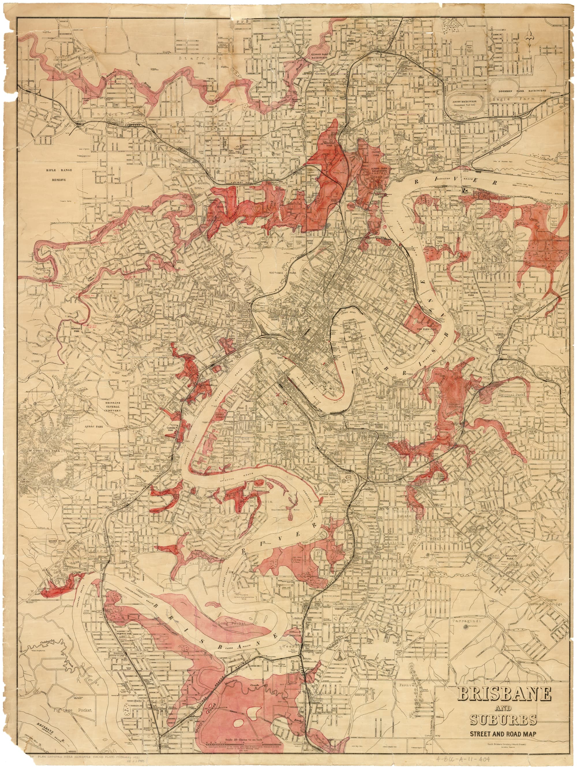
Brisbane Flood levels 1931
Map with hand-coloured areas in red showing extent of flooding in 1931.
Map - Brisbane 1931 Flood Levels, Brisbane City Council. May be reproduced for non-commercial purposes with acknowledgement.
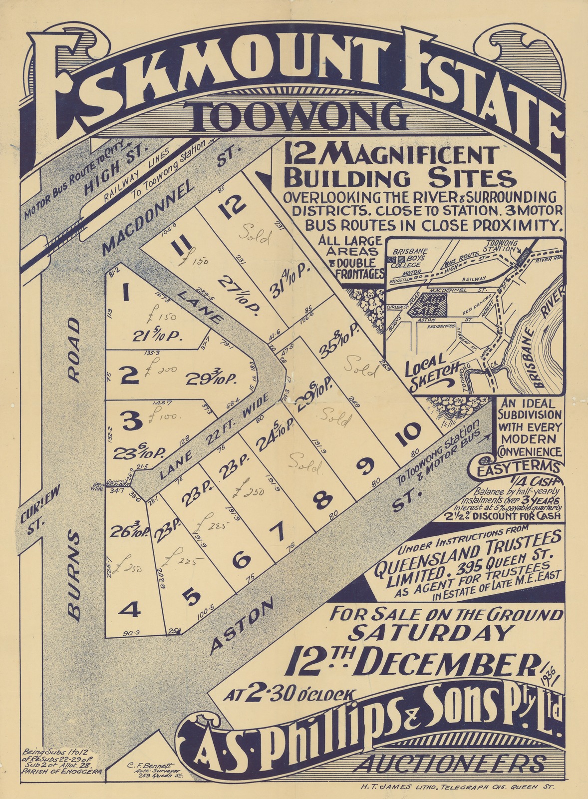
Eskmount Estate 1936
The Eskmount Estate map shows: Burns Road, Aston Street, High Street, Curlew Street and MacDonnel Street.
Eskmount Estate, Toowong A.S. Phillips & Sons, Auctioneers ; C.F. Bennett, Surveyor. 1936, State Library of Queensland
Toowong today
Compare a historic map with the present day.
![Plan of the Sylvan Grove Estate, Toowong, being subdivisions 1 to 28 part of portion 256, Enoggera John W. Todd [auctioneer]](../../assets/real-estate-maps/sylvan-grove-estate.jpg)
